Here are some of our photos from the trip. (Because of the length of this trip, I am breaking the photos up into several different pages. This third section is from our five day drive from Lhasa to Darchen for the trek.)
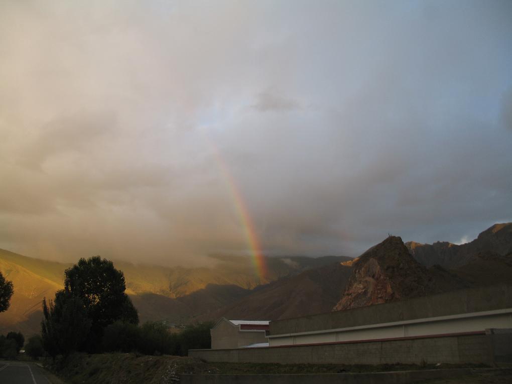
1) We left Lhasa early in the morning to start our 1000+ kilometer drive into Far Western Tibet. Just as the sun was rising, we saw this rainbow (or "Ja" in Tibetan). Since Ja are considered auspicious symbols in Tibet we took the sight of this as a good omen for our impending journey.
2) Since the first day was a short 250 km (155 miles) drive on paved roads we took a side trip up KangBala Pass so we could see the holy lake Yamdrok Tso. This pass involves about 80 km (50 miles) of switchbacks as it a climbs from around 3650m (12,000 ft) up to around 4725m (15,500 ft). This picture was taken near the top looking back down the valley. Since it is paved it would be a great road on a motorcycle...if it weren't for the rocks, animals, vehicles, weather, etc, etc, etc.
3) This panorama photo is looking down on Lake Yamdrok Tso from the top of Kangbala Pass.

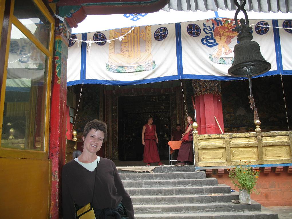
4) We also had enough time on our first day of driving to visit the Tashilhunpo Monastery in the town of Shigatse. This monastery is the home of the Panchen Lamas and it was spared some of the devastation that other monasteries experienced in the invasion in the 1950s and during the Cultural Revolution in the 1960s. This is Jonna in front of one of the temples in this large monastery complex.
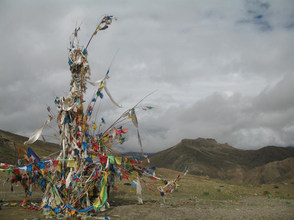
5) Every mountain pass in Tibet is considered sacred, though some are moreso than others. This is Tso La Pass. Each pass is decorated with prayer flags, mani stones, clothes and other offerings. As we drove over each one we would stop, throw bits of paper called Lung tar into the air (which symbolizes money) and yell "Ki ki so so, Lha gye lo"!
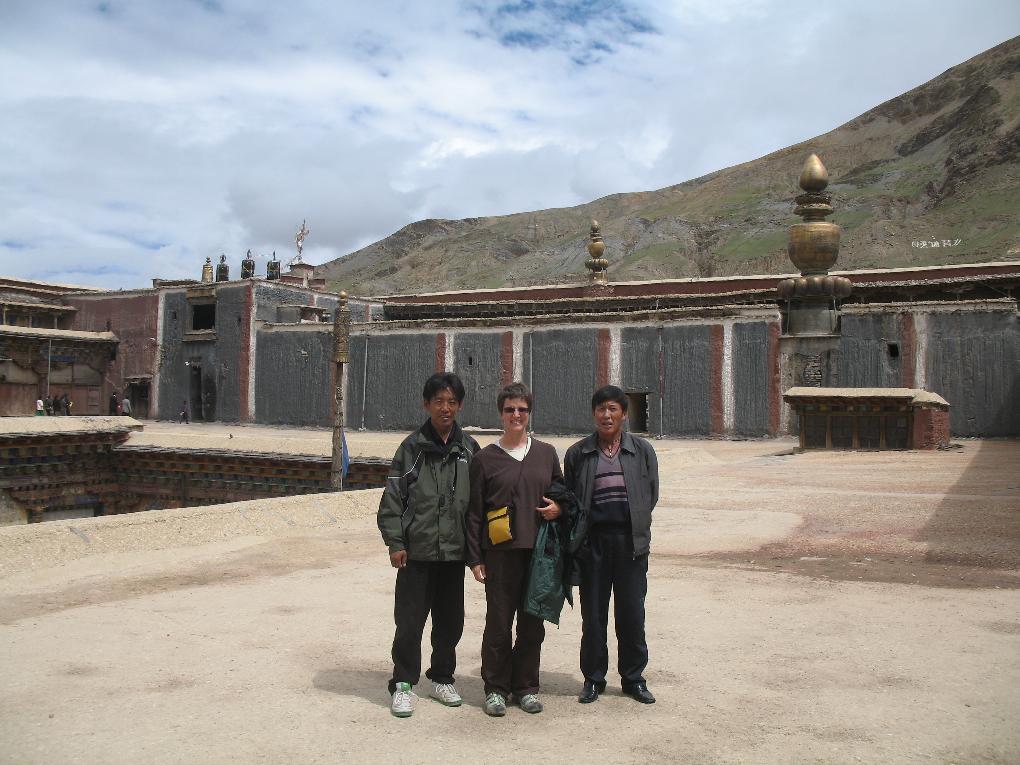
6) The second day of driving was another 250 km (155 miles) of paved roads to the town of Lhartse. On the way, we made a detour to see the Sakye monastery which is distinctive in its use of grey mud for the walls. Here is Jonna, with our guide Tsewang and our driver Tashi, on the roof of the Sakye monastery. Over half of Sakye was destroyed during the Cultural Revolution and the ruins are painfully evident on the hillsides around the buildings which are still standing.
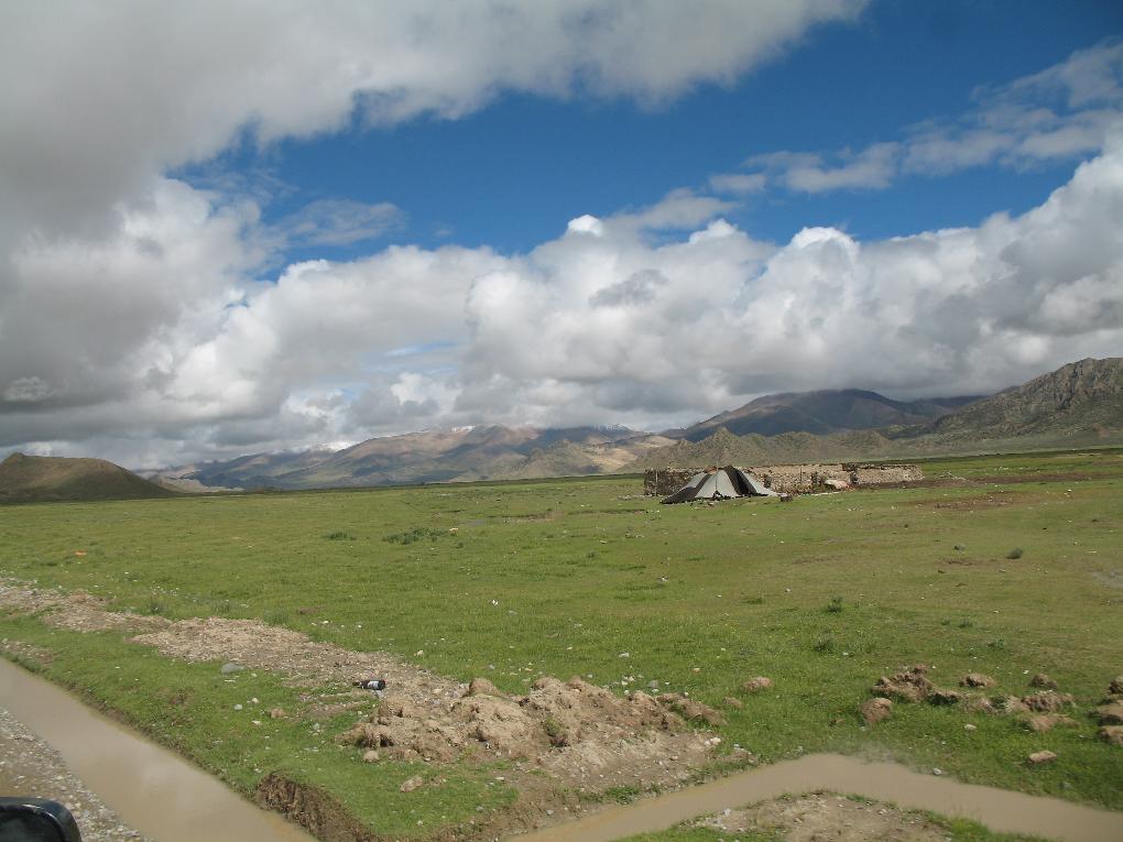
7) We stopped for lunch on the third day in the town of Zangzang. This was the first "town" we encountered after leaving the paved roads and electricity behind. It was immediately obvious it was mainly just a trading post for the tent dwelling traditional Tibetan nomads. The entire town was encircled with the nomad's yak hair tents like this one seen just west of town.
8) Large trucks regularly get stuck on what passes for a road when travelling across the tundra in Western Tibet. The permafrost melts in heavily used areas turning the tundra into a mud bog. In the afternoon of our third day of driving, we stopped just after Gye La Pass to find a route around a stuck truck and these two young girls got off their donkey cart to check us out as they had never seen caucasians before. I took their picture and showed it to them on the camera's display. They were amazed and entertained. The wonders of digital photography!
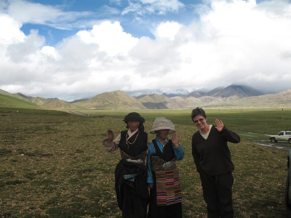
9) This was typical of the road through the valleys. This "road" is in the Raga Tsangpo river valley. The permafrost melts and leaves behind this muddy peat mixture. We would sometimes spend hours crossing a valley that was maybe 50 or 60 kms (maybe 30 miles) long, just churning away in 4 wheel low. The general path was to drive along a major river, then turn up a valley formed by a tributary and drive to its source. We would go over a pass and then follow the tributary on the other side back down to a major river. Our drive generally followed the Tsangpo which eventually becomes the Brahmaputra in India.

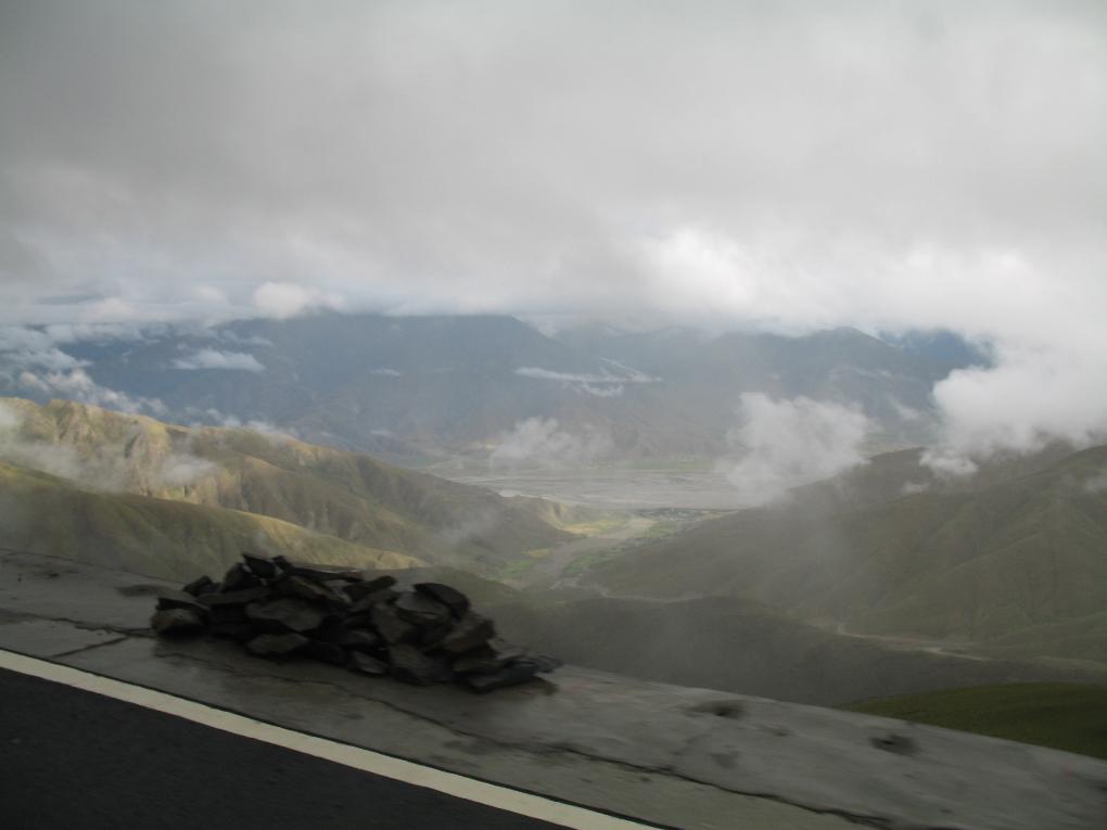
10) I can't remember the name of this pass about 2/3 of the distance between Lhartse and Saga but it was just one of four we did that day. What these pictures will never convey is the grand scale of everything in Tibet. These valleys are very wide, the rivers that run through them are huge and the mountains that tower over them are gigantic. You really do feel like a small insignificant speck in the midst of it all.

11) This Tibetan nomad was just going over the pass pictured above as we crested the pass. Nomads spend most of their entire lives in maybe one or two of these valleys where we went through three or four each day. They may only once in their whole lives get to visit the holy Jokhang Temple in Lhasa or scared Mt. Kailash, both of which we did in just three weeks. What a drastically different perspective on life exists between us.

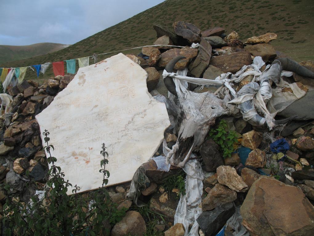
12) Saga La Pass, just before the military outpost of Saga, was one of the most spectacular passes of the trip. It is nearly 4875m (16,000 ft) in altitude and gives an almost 380 degree panorama of snow covered peaks. The entire pass is covered with prayer flags and offerings, including this piece of marble and this yak skull, both of which are carved with Buddhist prayers. This was a particularly peaceful after 10 hours bouncing around in a Land Cruiser while covering 300 km (185 miles) of muddy roads.
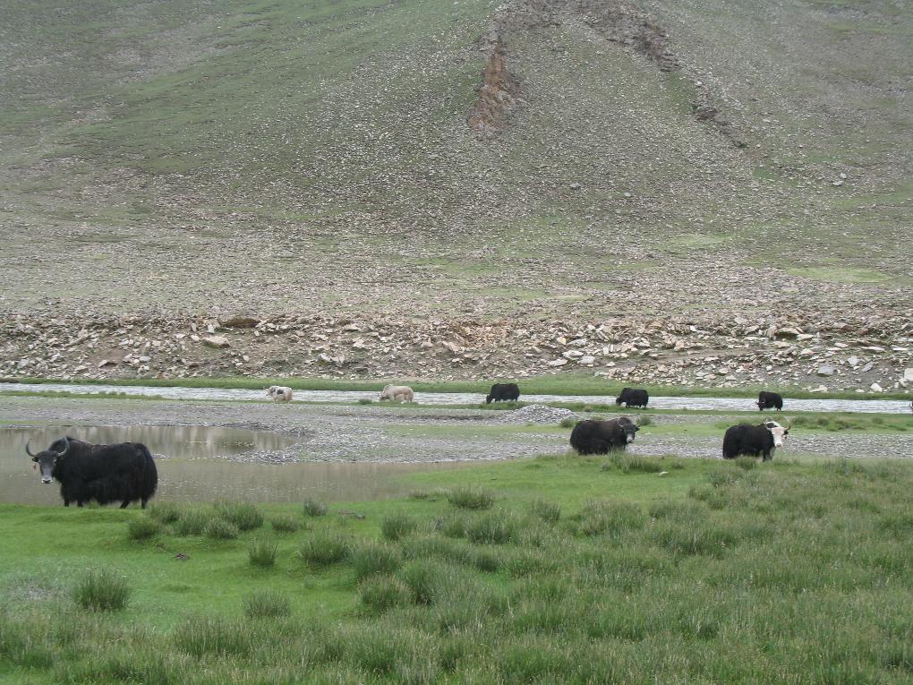
13) Leaving Saga on our fourth day of driving, we started our 250km (155 mile) drive by going up a valley along another tributary of the Tsangpo river. Yak herds are everywhere in this part of Tibet, so I took the opportunity to grab this picture of some of them hanging out by the river. While most of the domestic bovines in Tibet are Dzo, which is a cross between a yak and cow, our guide assured us that these were real Tibetan yaks.
Fluffy, happy yak
Enough space for a lifetime
Strong will and strong legs
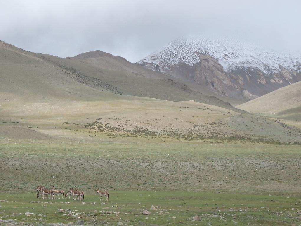
14) Our final day of driving was 280 km (175 miles) from Puyang to Darchen. Near the town of Horqu we came across herds of wild donkeys (called kiang here) which are common in Far Western Tibet. We saw a lot of wildlife in this part of Tibet including wild antelope, foxes, marmots, golden eagles, pika and a gerbil like rodent called an Abra.
![]() Go back to the second '06 Tibet Photo Page.
Go back to the second '06 Tibet Photo Page.
![]() Go forward to the fourth '06 Tibet Photo Page.
Go forward to the fourth '06 Tibet Photo Page.
![]() Return to Alan and Jonna's Travel Page
Return to Alan and Jonna's Travel Page
